
Setley Prisoner of War Camp
(all photos are © Peter Taylor)
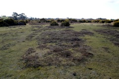 |
It appears that the darker patches in the aerial photo consist of roughly rectangular areas of heather or, in some cases, gorse. Probably these mark where the buildings were and that the paths and roads between the buildings were concreted and are still suppressing vegetation growth, other than grass. |
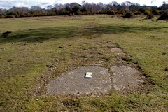 |
This was probably a path or road between the huts. I've placed the "Ordinance Survey Map of the New Forest" in the photo to indicate scale. |
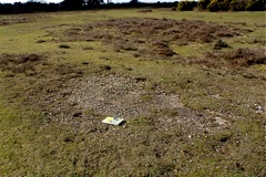 |
Possibly another section of road with a hut area beyond? |
 |
Possibly the Camp Entrance off the A337 Brockenhurst to Lymington road? |
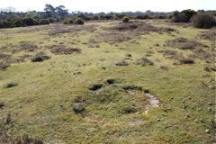 |
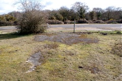
A circular concrete structure, possibly a well? |
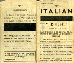 |
The front and back cover of Rose Chiverton's father's Italian PoW's ID card from when he was at the Setley Plain camp. Rose is keen to obtain further information about the Camp. |
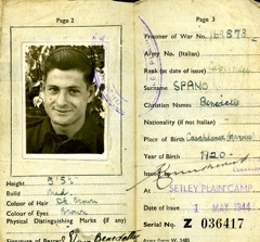 |
The inside pages of Rose Chiverton's father's Italian PoW's ID card from when he was at the Setley Plain camp. Rose is keen to obtain further information about the Camp. |
(to close this window, click on the main window, or use the "close" button on your browser)