History of the Setley Pond area
Pre-history (i.e. before the Club members can remember!)
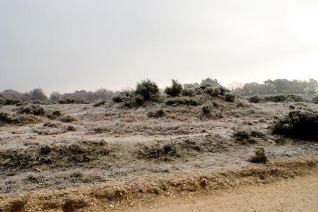
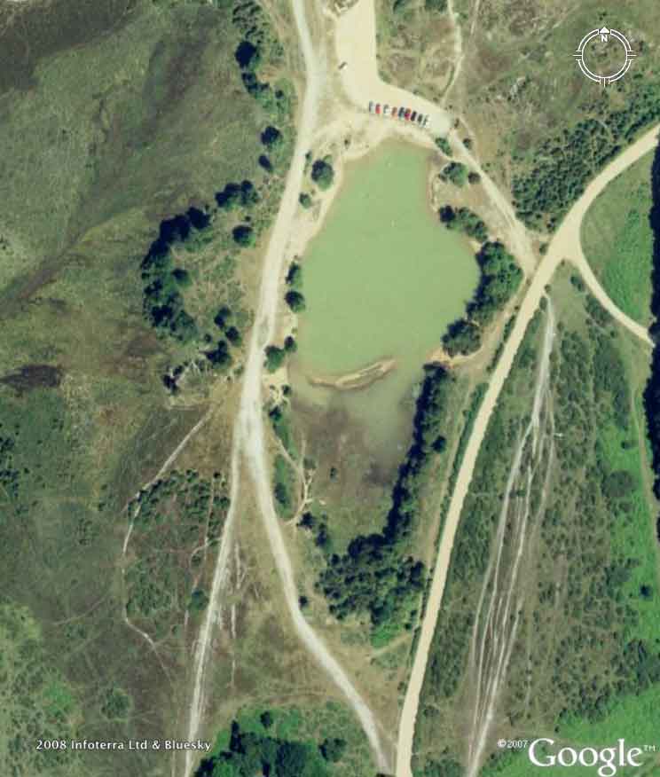
 Setley Plain features a number of prehistoric features. To the left of the track leading from the road to the Setley pond car park there is a Bronze Age "disc" or "bell" barrow. Consisting of a central mound surrounded by a ditch and external bank, the Setley Plain barrows are unique in the New Forest but also found on Salisbury Plain and other sites. This winter photograph shows the mound, ditch, and bank and also the relationship to the track to the pond... it's worth having a look at it!
A local Victorian landmark
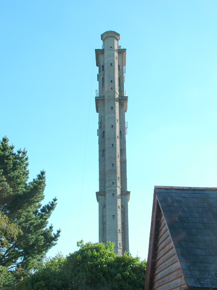
Visible from the path around Setley Pond is "Sway Tower", also known as "Peterson's Folly", near the village of Sway (the photo on the left was taken from the pond using a telephoto lens, click on it for a larger image). At 66 metres (200 ft), it is possibly the tallest folly in the world. It is a Grade II listed building.
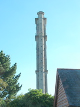 Built by Judge Andrew Thomas Turton Peterson on his private estate from 1879-1885, its design was influenced by the follies Peterson had seen during his time in India. It is constructed entirely out of Portland cement, supported by iron joists. At the time it was built, it was the tallest concrete structure in the world.
It was originally designed as a mausoleum, with a perpetual light at the top. However this was not allowed, as it was thought the light would confuse shipping. The tower is visible from much of the New Forest, and most of the western Solent. A smaller 50-foot (15 m) folly, built as a 'prototype', stands in a group of trees to the north of the taller tower.
Information based on Wikipedia; for much more information visit the "Folly Towers" web site.
Second World War
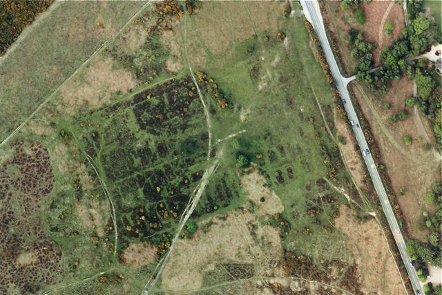
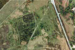 There was a Prisoner of War Camp west of the Brockenhurst to Lymington road, just south of the Filly Inn (OS Map reference: SU 301 998). The camp originally held Italian POWs, then Germans (source:BBC). The camp is still clearly visible in aerial photos. The camp entrance road appears to have been at the NE (top right hand) corner of the camp. However this may be a more modern feature.
For photos of what remains today, and an ID card for an Italian prisoner at Setley Click here!.
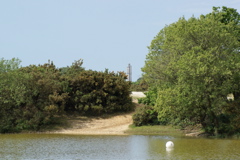
 We think that Setley Pond was a World War 2 gravel pit used in the construction of the airfield at RAF Lymington. It would be an odd location for a natural pond and the pond is not marked on the 1919 Edition of the OS Map. If anyone has further information, please get in touch.
The Club
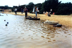 Some photographs from the earlier days of the Solent Radio Controlled Model Boat Club taken by Ken Dyer. No pond-side car park, and pigs rather than Highland Cattle!
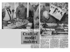
Press-cuttings from two of the earlier "Highfield Shows" arranged in 1988 and 1996 by the Solent Radio Controlled Model Boat Club in aid of the RNLI.
|